
Start a Medford Street Directory Search
A useful by-street search starts at the Burlington assessment portal. Select Medford Township, enter a street in the Property field, and save the returned situs text, owner name, block, lot, qualifier, and any deed-book or sale fields. Then compare the parcel against the tax map or GIS service. That sequence turns a street string into keys that can be checked, rather than treating a street name as proof about a person.
- Search the Burlington County Property Assessment Search with Medford Township and the street or house number. Record the situs and BLQ for each parcel that matters.
- Check the parcel shape and tax-map context through the county map resources. A map can show whether an address is part of one lot, several lots, or a larger tract.
- Use the owner name, deed book and page, or instrument reference in PRESS to locate the recorded instrument.
- Read the legal description and the grantor and grantee names. Search the seller as an earlier grantee only after matching the same parcel details.
- For a dated personal connection, use individual election-status checks only as permitted, then consult library newspapers, maps, or archival material. New Jersey does not offer a casual public street-browse voter roster.
That order also prevents a common error: an owner mailing address can differ from the property address. A mailing field may point to a trust, estate, business, tax representative, or another location. It is a lead for a record search, not proof of who is present at the Medford parcel.
Medford Street Directory Assessment Filters
The assessment portal is the strongest current starting point for a Medford address workflow because it exposes a street-oriented Property field alongside owner and BLQ searches. The portal displayed an imported-data marker of August 5, 2026 during the research inspection. Its results can be sorted and downloaded, but the portal also displays a maximum-download warning. Keep a broad street pass narrow, and preserve the portal date beside any notes.
| Portal field | Street use | Documented behavior |
|---|---|---|
| Town Filter | Limits a search to Medford Township | Choose the township, not Medford Lakes. |
| Property | Finds street or address text | Use a street name for a broad pass, then a house number to narrow. |
| Owner Name | Connects a name to parcel results | Useful after a deed or tax record supplies a party name. |
| B.L.Q. Filter | Finds a known parcel | Uses the block, lot, and qualifier key. |
| Class, sales, size, year-built filters | Reduces a broad set | These filters describe the parcel or transaction, not a household. |
The captured interface did not state which search fields were required. It did document * for any characters and ? for one character. Use those wildcard rules only where the portal accepts them, and do not assume a blank result means the address never existed.
The assessment-search interface is shown below with its Medford Township, owner, property, BLQ, class, sale, size, and year-built controls.
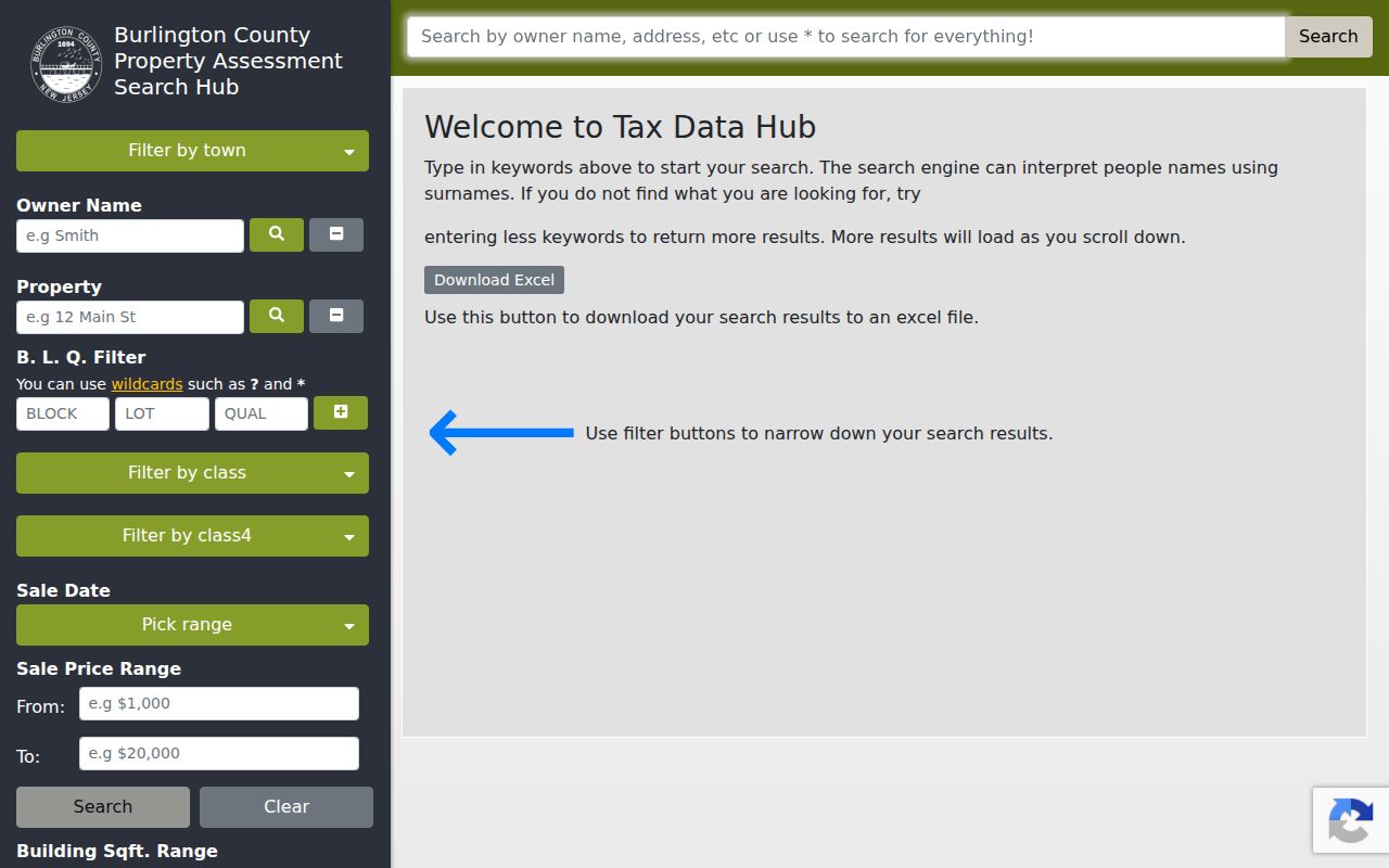
Those fields let a researcher move from a street term to parcel-specific evidence without claiming that a tax result names every person at the address.
Medford Street Map Fallbacks
The county describes its Property Viewer Web Map and recommended mapping application as currently offline. That status matters. The ArcGIS item still documents the intended street search modes: an address in the form street address, town, a township-block-lot key, or an owner name formatted as Last name, First name. It also describes parcel popups, layers, legend, measure, and details controls, but a description of a viewer is not the same as a working viewer.
The county GIS status page records the offline notice and also points to historical USGS maps.
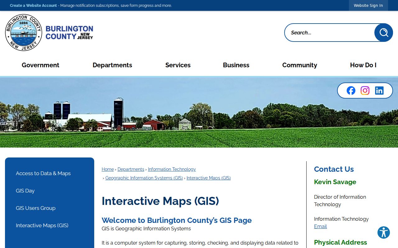
When the interactive map is unavailable, use the status page, tax maps, the technical parcel layer, or the GIS office instead of describing a live parcel click that cannot be completed.
The technical Burlington parcel REST layer remains inspectable. It supports queries, pagination, statistics, GeoJSON and PBF output, with a maximum record or selection count of 2,000. Its schema separates address components from owner-mailing fields and includes deed book, deed page, sales date, tax-map page, block, lot, and qualifier.
The REST parcel-layer capture shows the technical fields available when Medford parcel mapping needs a documented fallback.
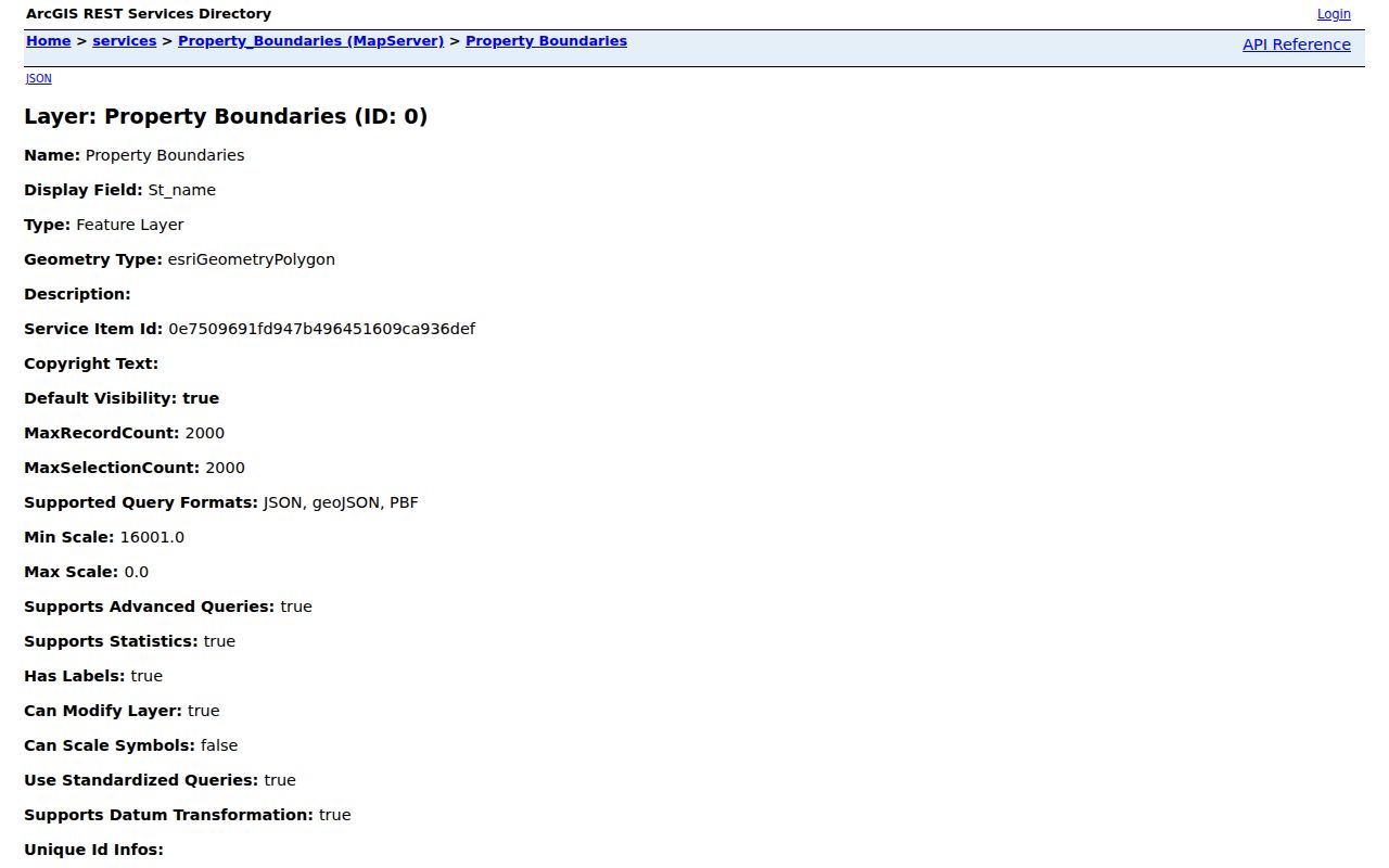
The layer is a parcel source, not a deed-image service, and its rich schema does not turn into a complete resident list.
Medford Records by Street Address
Several Medford record sets are keyed to an address or parcel, but they answer different questions. The assessment roll is a current tax snapshot. GIS supplies parcel geometry and context. PRESS supplies a recorded-instrument trail. A permit packet can show an application or review at an address. Each source should stay in its own lane, especially when a mailing address and situs address do not match.
| Address-keyed source | Custodian | What it can establish | Access route |
|---|---|---|---|
| Assessment roll | Medford Assessor and county tax system | Current owner record, situs, mailing field, BLQ, class, sales, and physical attributes | Portal or assessor counter at 49 Union Street. |
| GIS parcel layer | Burlington County GIS | Parcel boundaries, BLQ, tax-map context, zoning, and deed or sale schema fields | Offline viewer status, REST layer, tax-map page, or GIS office. |
| Recorded instruments | Burlington County Clerk | Grantor, grantee, instrument, book or page, type, and recording date | PRESS, pre-1965 archive, or Clerk hard-copy access. |
| Permit or code file | Medford planning or construction offices | Address, applicant or owner, project description, and review dates when releasable | Narrow office or OPRA request. No public search portal was verified. |
| Historical map or newspaper | BCLS, historical organizations, and Princeton collections | Structure context, legal notices, and dated local references | Digital collection, library access, microfilm, or research appointment. |
County records are not held at one Medford counter. The assessor handles local parcel work, while the County Clerk in Mount Holly keeps recorded instruments. The county OPRA route is the fallback for a focused non-indexed administrative record, subject to redaction and exemptions.
Note: Keep the source date and access route beside each address result, because a current tax entry, a deed, and a map record different events.
Medford Deed Chains by Street
PRESS is where a street search becomes a recorded-property trail. Start with the current owner, deed book and page, or instrument number from the assessment and GIS material. In PRESS, choose Medford Township where the mode asks for a municipality, then use the name, document-type, date, or BLQ route that matches the information in hand. Read the instrument rather than relying on the index label alone.
Online name searching reaches back to 1965 for most document types. The county notice gives block, lot, and owner searching for records on or after March 1, 2012. For an earlier parcel search, first use a party name and then compare the legal description and tax-map details. The word berg% can broaden a surname beginning with that text, while %berg can find names ending in it.
The county PRESS index presents the document, instrument, book, page, municipal, date, BLQ, and party-name modes used in that chain.
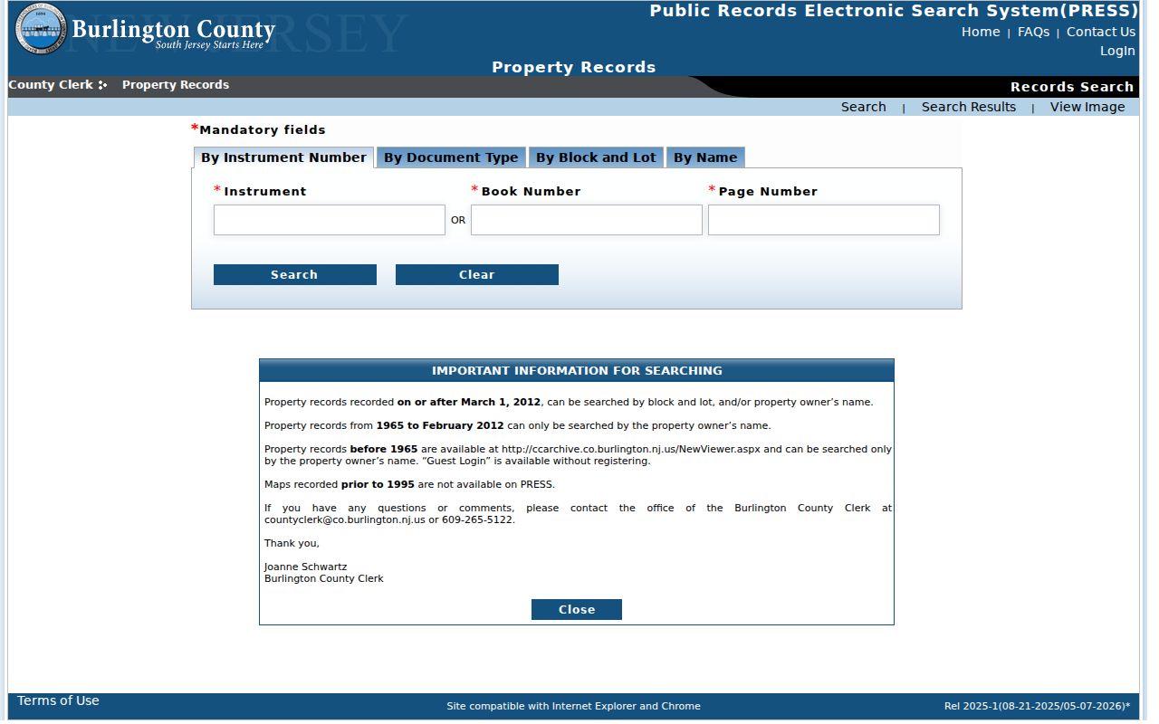
The basic public view uses watermarked images. Registration permits a no-watermark view, and unavailable records can be checked in hard copy at the Clerk's office.
Note: A recorded index result identifies an instrument trail, but it does not replace reading the legal description and the image when available.
Medford Address Terms for Street Searches
Old deeds often use a parcel description instead of the street wording used today. Recording these terms before moving backward keeps the Medford address trail reproducible and makes it easier to spot a parent tract, an added lot, or a shared development record.
- Parcel
- A mapped tax unit identified by keys such as block, lot, qualifier, and tax-map page.
- Situs address
- The physical location of the parcel. It differs from the address where tax correspondence is sent.
- Plat
- A recorded or mapped subdivision plan used with the tax map and legal description to distinguish lots.
- Criss-cross directory
- An address-arranged directory, if a library actually holds one. No verified Medford run or year range was located, so ask the library for the publisher and scope before relying on it.
The GIS schema also uses fields such as Prop_locat, Owner_Addr, and Owner_Zip. The first concerns the property location; the latter fields concern mailing information. Neither field proves a full set of occupants.
Medford Street Permit and Notice Files
Medford planning and zoning materials identify categories such as fence, shed, sign, pool, tree-removal, zoning-only, wetlands-buffer, professional-review, and variance packets. A packet can tie an address to an application, an applicant or owner, a project description, and review dates. It cannot by itself establish that work was completed or that a person lived there.
No verified Medford permit or code-case search portal was found. For a narrow question, describe the address, date span, and specific file sought in an OPRA request or ask the relevant township office for the proper record route. County sheriff sale notices can provide parties and process dates, but the research record treats a notice as a legal-process clue, not proof of occupancy.
Medford Street Records and the PRESS Split
The important local quirk is that PRESS has two different online boundaries. A name search can reach back to 1965 for most document types, while the stated owner and BLQ search coverage begins March 1, 2012. A researcher who has only a street address for an older transfer must first recover a party name, book and page, or other parcel evidence rather than assume the modern by-address route reaches the same years.
Before 1965, use the separate county archive through its owner-name route or visit the County Clerk for hard-copy indexes and deed books. Clerk staff are not title searchers. The chain remains a research chronology, not a title opinion.
Medford Street Evidence in Maps and News
For a street that predates current parcel tools, historic sources add context rather than a ready-made address roster. The Princeton guide has Medford Sanborn map sheets for 1908, 1915, and 1924. Start with the first or index sheet, then compare the structure footprint, use notes, and street setting across sheets. A change can help date a building or alteration, but it does not identify every person connected to the property.
The BCLS local-history collection is another dated source. Its Central Record material covers 1975 through 2021, with full text from 2001 in NewsBank, while earlier searching may depend on indexes, microfilm, or other library access. Use a street's historical spelling, Cross Roads or Church Road references, postal village labels, directional prefixes, and tax-map descriptions before treating a failed match as absence.
The ArcGIS property-viewer item documents the intended address, owner, and township-block-lot search formats for Medford parcels.
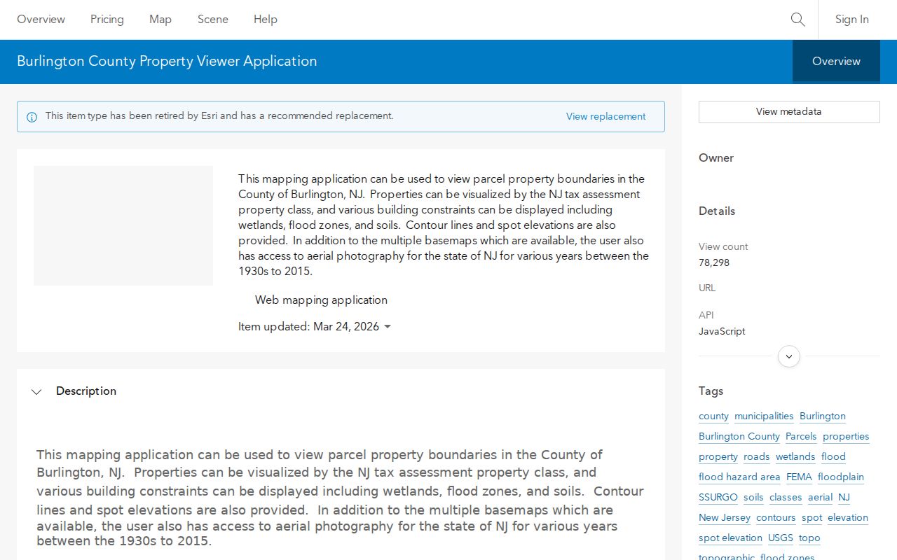
Because the county status page reports the public viewer offline, use this capture as interface documentation and follow the available fallback routes for current parcel work.
Note: Preserve the original street spelling and parcel context when comparing maps, notices, and recorded instruments from different periods.
Limits of a Medford Street Directory
A Medford by-street search can connect public property and recording evidence to an address. It cannot reveal a complete household, utility or delivery customers, protected addresses, private relationships, or informal occupancy. The state voter tool is individual and registration-oriented, not a public street browser. Protected voter records, Address Confidentiality Program participants, and Daniel's Law protections must remain protected.
When the goal shifts from a current address chain to old directory collections, the local holdings and their limits belong on the Medford city directory page. That historical work may supply a dated clue, but it still needs confirmation from the record custodian.
Medford Street Records at the Counter
Online search is only one channel. The Medford Assessor is at 49 Union Street and lists weekday hours of 8:30 a.m. to 4:30 p.m. The Burlington County Clerk is at 50 Rancocas Road in Mount Holly, open weekdays from 8 a.m. to 4 p.m., and directs search help to 609-265-5122. County GIS lists its office at 122 High Street in Mount Holly, 609-265-5125, on weekdays from 8 a.m. to 5 p.m.
For a known instrument, the Clerk's copy route accepts a document type with book and page or instrument number. The county describes regular copies at $2 per page, certified copies at $10 for certification plus $1 per page, and a self-service copier at five cents per page except large maps. These are distinct channels, so label the route used rather than combining the prices.